September - November 2008

September - November 2008
Route: From Bangkok overland through south Thailand to Malaysia, seeing Kuala Lumpa and Singapore). Singapore --- Perth (I don't know whats in Perth! Must be something to do there though). Perth --- Brisbane (then travel overland to Sidney). Sidney --- Auckland (travel round New Zealand's islands probably by road). Auckland --- Tahiti (laze about on South Pacific beaches).

3 December 2008

Taupo

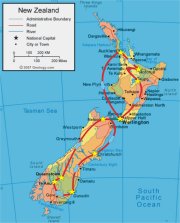
We were a bit sad to leave the south island. Driving around there was a lot of fun – we saw seals, albatrosses, penguins, sea-lions, lots and lots of sheep, and some of the most spectacular scenery we’ve ever seen. But none the less we had to move on back North to move forward… after all, we do have a flight to Tahiti to catch in a few weeks! So we gave the Nissan back to ACE rentals at Picton, hopped on another ferry across the Cook Striates and stopped-off in Wellington briefly… during which time it never stopped raining. To avoid dissolving completely we swiftly hired another car which turned out to be yet another Nissan Sunny… this one automatic to my horror (although Gary admitted he missed gears too – he’ll see the light!). And so we prepared to drive up to Auckland … stopping off at a few places en route of course.

We decided to spend a few days in Taupo - to wander around the beautiful lake we had glimpsed a few weeks earlier on our long coach journey south from Auckland to Wellington. Lake Taupo is the largest in New Zealand, a hugely scenic expanse of water snuggled in the midst of volcanoes. But as we drove north from Wellington we got a bit distracted! As soon as we left Wellington it stopped raining (yay!) but oddly for New Zealand the scenery wasn’t that remarkable at first. But this all changed when we reached the ‘Desert Highway’. Not a good title – definitely not a desert. No sand, cactuses, and it was pretty chilly, despite being late spring. The ‘Desert’ is actually an area of volcanic ash left from an eruption of numerous surrounding volcanoes in the past. It’s mostly a barren wasteland, with only tufts of grass punctuating black soil, but in the distance you can see the snowy peak of one of the volcanoes responsible for all the destruction... very beautiful!

Anyway, realising we’d ventured into volcanic country we decided to have a break from our journey on the southern shore of Lake Taupo at a small thermal spring area. And here we became completely addicted to wandering around natural hot-pools and holes of bubbling muck! It’s strangely fascinating and hypnotic to gaze at steam rising from a crystal clear bleu-green pool, or watch mud to burst up in miniature liquid explosions from the ground! And of course to try and photograph the perfect mud bubble bursting! Saying that, we also found watching the sun set over the volcanoes flanking Lake Taupo later that evening pretty fascinating - the clouds turn more colours than seem possible.

I suppose this sums up what we enjoyed most about Taupo: geothermal activity and water! Just north of lake Taupo is Hukka falls and the Aratiatia Rapids, where pale blue crystal water cascades in impressively powerful jets over the rocks… although unfortunately the cascading only happens a few times of day for the Aratiatia rapids as they’ve built a hydroelectric dam just above them and open the water gates every now and then. But it’s all very pretty to watch if you turn up at the right time! We also liked a much smaller stream near Lake Taupo which was naturally hot – flowing directly from a geothermal hot spring. It seemed to be a favourite place to go and bathe for locals, although we just waded about for a while.

But perhaps our favourite thing in Taupo was The Craters of the Moon. This is a small geothermal park – a very hyperactive, small geothermal park – which formed relatively recently following the construction of a geothermal power station nearby. Unfortunately it doesn’t boast any hot-springs, but has wonderful craters, pools of mud, and very active fumaroles belching vast quantities of steam into the air. We spent ages wandering around the tracks gazing at the sulphuric wasteland near the craters, or the patterns the rising steam made when swirled by the wind. Absolutely beautiful in a very desolate way… as long as you ignore the smell of rotten eggs!

Which is perhaps why we’re so excited about our next destination – Rotorua. This town is situated in the midst of the most geothermaly active areas in New Zealand. It has geysers! And (apparently) Rotorua has much more impressive areas of geothermal activity than any near Taupo. Brilliant!

1 December 2008

Taupo Photos

The stunning 'desert' of volcanic ash in the central North Island, complete with stunning volcano in the background!
One very steamy hot-pool - fantastic green water, crystal clear, and very warm. In this particular area on the south shore of Lake Taupo there were a number of springs, each with beautifully clear blue or green water. There were also a few small mud pools, where liquid mud plops continually! Moving down, these with the rapids below the hydro electric dam near Taupo. Spectacular (if brief) flow when the flood gates are opened!


The Craters of the Moon! OK, it didn't look much like we imaginged the moon, but it was still great. This is Gary by a particularly impressive hot steam vent.

After being thrashed in mini-golf, Gary had to show his skills at the real thing... sort of! His shot out to the mini island in Lake Taupo was pretty brilliant - the ball landed just next to the target (where I've marked the cross on the water).

A beautiful sunset over Lake Taupo. And it was like this virtually every night...


Nelson

Nelson is on the coast, right at the Northern end of the South Island. Now since Queenstown is only about a quarter of the way up the South Island, and duel carriage ways are as rare as the kiwi in New Zealand, unfortunately we had a bit of a trek to get there. OK, a trek through yet more stunning scenery, this time predominantly mountainous. The most striking things we saw were some large turquoise blue lakes in the Southern Alps (have a look at the photos below). They were amazing – as if someone had dissolved vast amounts of copper sulphate in the water. Apparently the colour is due to the mineral composition acquired by the glacial melt. What minerals? I don’t know! But it looks incredible!

Anyway, after a good 12 hour drive we arrived at Nelson, which turned out to be a pretty little didn’t have the energy to wander far the following day! But after a bit of recuperation we spent a day driving to the west side of the north coast, to Farewell Spit. This is a huge sand-spit, stretching miles and miles out to sea in a graceful curve to the north east. You could see it on an atlas or satellite image – a bit like a scimitar sticking out from the top of the South Island! As it’s pretty remote, Farewell Spit acts as another reserve for rare birds and seals to bread. So if you go to the right place you can see baby seals playing in pools on the beach!

On our way back to Nelson we called in on the edge of the Abel Tasman National Park. This reserve takes up a large part of the mid section of the north coast, and is pretty inaccessible by anything other than boat (or walking I suppose). We only had time (erm, daylight) for a short wander near the water but it was still lovely.

Anyway, we now leave for the north island by ferry – and intend to round off our visit to New Zealand with fire. Literally! We plan to spend the last few weeks in the geothermal areas of Taupo and Rotorua where you can find hot-springs, bubbling mud, geysers, steaming pools… yet another contrast!

Nelson Photographs

Turquoise water? These lakes in the Southern Alps were incredible. The water really was the colour you see in the photo - we didn't use a filter on the camera or anything!
One of the large sweeping beaches on the North East coast of the South Island. With a very small Vicki looking dwarfed by the mountains!

The graceful curve of sand stretching off into the distance (and off the photo for that matter) is Farewell Spit. We wandered out onto the spit as far as the end of the trees... which took about an hour!


Abel Tasman national park. Or at least the edge of it.


23 November 2008

Queenstown

So far in New Zealand we’ve seen a lot of the outdoors. Very impressive outdooredness at that – beautiful volcanoes, sublime beaches, spectacular lakes and waterfalls… you get the picture. And of course we’ve had some fantastic encounters with wildlife along the way. But as well as its untouched natural state, New Zealand is also famous for adventure tourism. You know – white water rafting, skiing, jet boating, parachuting, that sort of thing. And the capital of adventure tourism in New Zealand is Queenstown.

Queenstown is in the middle of the southern South Island, amongst the mountains on the shore of Lake Wakatipu. It’s another idyllic setting – although when we first arrived it was pouring with rain and looked incredibly bleak! We thought we should enter into the spirit of the place, and so as soon as the weather cleared up we decided to take a gondola to the top of the nearest mountain so we could jump off! Yes, bungy! Neither of us had tied it before, and as commercial bungy jumping was started in New Zealand it seemed only appropriate to give it a go here…

We fancied ‘The Ledge’ bungy. This 45m drop is placed right at the top of the mountain (conveniently near the gondola station), so as you plummet from the edge you have fantastic views of Queenstown and Lake Wakatipu 400m below you. Making the drop seem even more impressive… It’s one of the places where they strap the bungy rope to a harness you wear on your body rather than your feet, so you can take a running jump over the edge. Gary decided not to run – he kind of stepped over and then went straight down! I ran and then dived over the edge…

It’s a strange feeling as you drop – your mind knows that you’re strapped to a thick elastic band but your body protests ‘what have you done!’ as you jump! I think it’s impossible not to yelp with surprise as you actually freefall – and this goes on for some time. And trust me, it feels a lot longer than the few seconds it is! Gary had an advantage here. As he couldn’t jump with his glasses on (and he’s virtually blind without them), he had reassuringly fuzzy images as he fell – compared with my crystal clear views of Queenstown 400m below me! Argh! But then you feel some reassuring resistance on the rope, slow down a bit and – doing – bounce back up all over the place! Great fun! Really silly!

Anyway, we now have to abandon the Southern bits of the world, and start to return north. We think we’ve just passed the point where we’re the furthest from the UK in Te Auau. Now we have a very long journey ahead to Nelson at the top of the South Island, before we loose our little Nissan car and jump back on the ferry across the Cook Strait in a few days time.

Queenstown Pictures

This is a view over the beautiful Lake Wakatipu from the top of the gondola ride out of Queenstown. And it is a very similar view you get to this as you plunge 45m or so from the bungy jump…

… from this ledge! Here you can see Gary dangling from a long rope as he finishes his jump.

But here you can see a few piccys of us jumping, falling, swinging, and generally making idiots of ourselves. Its great fun! Very scary.

Another lovely view from the top of the mountain area, this time as we went for a gental walk around rather than throwing ourselves off the edge.

Gary at the bottom of the valley, on the edge of the lake near Queenstown. It’s a very pretty place from this level too.


Te Anau and Milford Sound

The south east corner of New Zealand’s South Island is occupied by a series of fjords – dramatic flooded glacier sculpted valleys. The only one of these to be properly accessible by road is the most northerly, Milford Sound. And in all fairness even Milford Sound takes a bit of effort to get to!

There aren’t many options for staying there once you do arrive either, so we checked into a motel in Te Anau, a small town on the second largest lake in New Zealand. This is the last stop before Milford Sound – the last trace of civilisation (i.e. petrol station) for the 120 km trek to the fjord itself! Te Anau is a pretty place, especially good for evening strolls as the sun sets over the mountains around the lake, but it is small. Unless you compare it to Milford village of course.

The 120 km drive to the fjord from Te Anau is spectacular. It starts along the shore of the lake before continuing down a huge glacier carved valley: dramatic mountainous snow capped cliffs on either side rising from the near flat valley floor. After passing a few more lakes the road then twisted up the side of a mountain to a new valley and followed it along – before rising to a flattened rocky area almost at the snowline. We inevitably had to wait for a while as the road plunged down through a steep tunnel through the mountain, a one-way tunnel with traffic lights set to a 15 minute delay! But at least there was plenty to keep us entertained: lots waterfalls cascading down the cliffs around and plenty of mountain Kia (intelligent New Zealand parakeets) playfully begging for food. After finally getting through the tunnel, the road then wound down the steep lower mountain slopes in a series of hairpin bends, past yet more dramatic waterfalls, to reach the forest below, and then finally to drop into Milford Sound itself.

The fjord is really beautiful – more dramatic cliff-mountains, this time half drowned in water, and even more dramatic waterfalls than any we’d yet seen en route. We wandered around parts of the shore that were actually accessible (the bits that weren’t cliff faces), and as the tide was out ventured out over the seaweed and pebbles usually covered by water. And we took lots and lots of photos!

Anyway, pretty though Milford may be, we are now moving on to Queenstown… which we are reliably informed is also very pretty! What a surprise! Queenstown is also the home of adventure tourism in New Zealand – you know jet boating, skydiving, bungee jumping, white water rafting. This should offer a nice change of pace.

Te Anau and Milford Sound Photos

A nice view down one of the glacier sculpted valleys we saw on our drive down into Milford Sound. It was a bit chilly – as you can see we get pretty close to the snow line up here. And the wind chill factor outside the car was impressive!

Milford sound itself. Beautiful valleys half drowned where the river meets the sea. It was stunning – especially if you consider the beautiful waterfalls cascading down the valley walls…

… such as this one!

This is a Kea, a highly intelligent parrot that doesn’t fly much, but wanders around mountain slopes (especially where drivers stop off to give a few crumbs)! They treat visitors to the area with the distain they deserve.

Another beautiful glaciated valley, between Milford and Te Anau. This one had a perfectly flat meadow as its base which looked unbelievably green and lush.

Sunset over the lake at Te Anau. Not a bad view from our motel room eh?


17 November 2008

Dunedin

Dunedin is described by our Rough Guide a ‘the Edinburgh of New Zealand’. The name is even meant to e derived from a Gaelic version of Edinburgh apparently. So we weren’t exactly surprised that we arrived to bleak skies, howling winds and drizzle. Very Scottish!

Dunedin is a pretty little place though – nestled in the hills off the coast of the south-eastern South Island, near the Otago Peninsular. It’s a lot smaller than the original Edinburgh, but just as wet, and with some comparable hills and mountains around. Bleak, gorse-strewn and windswept, with the odd rain-soaked shivering sheep wandering by! Perhaps that’s a bit unfair – for most of our stay it was actually quite sunny (if a bit chilly) – but as we first arrived we drove over the hills from a beautiful afternoon on the east coast, to descend into Dunedin and drizzle. And then pulled up by our hotel just by the Cadbury’s factory whose hauntingly nice smells gave us chocolate cravings!

The journey from Christchurch down to Dunedin wasn’t quite as scenic as that from Picton, but it wasn’t bad. Most of the first half of the journey was through the planes south of Christchurch, pleasant enough - large, lush, very flat cattle pastures and glimpses of the distant Southern Alps - but a bit dull after an hour or so of driving. Fortunately the road then returned to the coast making the trip much more interesting… and much longer since we kept on stopping to have a look! Harbours with turquoise water, sandy coves, sweeping beaches with mysteriously round honeycombed boulders… and more wildlife of course! We drove off down a 5 km gravel track to an old wooden lighthouse so we could watch a yellow eyed penguin catch fish off a tiny isolated beach (while much lazier seals basked on the sand nearby). Penguins waddle so clumsily on land – but swim beautifully smoothly.

We found that Dunedin is actually a very good place to stay to see even more creatures since it is immediately adjacent to the Otago Peninsular. We spent quite a bit of time driving around this place than we originally intended - well its very pretty, and has loads of weird animals! Albatrosses for instance. The headland of the peninsular is the breeding ground for Royal Albatrosses – imagine something a bit like a seagull but with a 3 m wingspan! We weren’t too impressed with the idea of them before we saw one, but then we stayed around for ages in the freezing wind spotting more. They are absolutely huge – wings like gliders. And they never seem to flap, they just hang in the air somehow.

Just next to the albatross headland was the home of another set of birds – this time little ones. Blue eyed penguins nest there. They are only 20 cm tall, spend all their days fishing to come home in fleets at dusk. We saw about 50 of them come onto the beach and then hurry up some steps from the sand to their burrows. They were possibly as sweet as those koalas we saw back in Australia! There are less sweet inhabitants of the peninsular however. While waiting for the penguins to return home from their hard day fishing we took a stroll along a nearby beach and almost bumped into a sleeping sea lion. It was tucked up at the edge of the dunes and had almost covered itself with sand. We had taken it for a rock and only realised our mistake when we were a few meters away – this wasn’t meant to be a beach where seals or sea lions were common! And sea lions are actually very big, grumpy and aggressive, so you are never meant to get within 5 m of one - or between it and the sea. Which is exactly where we were when we saw it! It seemed to be snoozing happily however, so we walked swiftly past, and then climbed onto the top of the steep sand dunes behind it to walk back along the beach to where our car was parked. Much safer and more sensible yes? Well, we thought so. But the very rough track along the dunes gave us an excellent view of the sea lion at a safe distance, so we couldn’t resist a few photographs. At which time the monster woke up, decided he didn’t like us and barked very fiercely. Showing lots of big white teeth! We got the hint and dived away into the shrubbery on top of the dunes. Not the best route! A quarter of an hour of scrambling through tough grass and spiky shrubs brought us to the side of someone’s back garden… where a local dog took offence and we got barked at again. And we were only trying to have a nice stroll on the beach! Leave us alone!

Ah well, next we go to Te Anau, a lakeside town close to the Fiords of South Western New Zealand. Apparently this is the gateway to some of the most beautiful places in New Zealand. Which based on what we’ve seen so far should be pretty impressive!

15 November 2008

Dunedin Photographs

This bay was at Oamaru, halfway along our route from Christchurch to Dunedin. Apparently yellow eyed penguins can be seen here in the evening, but unfortunately we were here too early in the day to see them (so we stopped a little further down the coast to spot one instead). It was a lovely cove anyway, with a pretty cliff-top walk overlooking the beach. If you’re wondering, I’m balanced on a 5 cm wide fence at the top of the cliff so Gary could get as much of the scene in the photo as possible… and behind me is a near vertical drop down to the beach below. Nice to have a good sense of balance eh?

A very beautiful beach, with some very beautiful boulders in the distance on the left...
The Moeraki boulders. These spherical lumps of rock were stranded halfway along a vast and beautiful stretch of sand… kind of in the middle of nowhere. Lots are now broken up, revealing a sort of honeycomb interior, but there are plenty of intact ones too. The largest are about 2 m diameter – perfect for jumping between! I think I must have hopped back and forth between these rocks about 25 times before Gary got the timing perfect for the photo… and he didn’t exactly volunteer to have a go himself. I don’t think he liked the thought of falling off into the surf and getting wet! Wimp!

Gary by the rocks, from the safety of the beach. Well, at least he thought he was safe. A few minutes later while photographing me perched on a different rock he didn’t notice the waves coming in so got his feet wet anyway!

This picture was taken near the albatross centre on Ontago Peninsular. The headland overlooked a bay almost sealed off by an impressive sand spit. And this headland was home to more than a few seagulls as well as albatrosses – these two flew straight at me as I was about to take a photo of the sand spit, so I thought I might as well snap them too.

A magnificent Royal Albatross. Yes, I know, it looks like a sea gull. But it’s not. It’s much bigger, OK? Trust me. You have to see these things in the flesh to appreciate the 3 m wingspan, but I think this photo gives some sort of an idea.

The first small group of very very sweet blue eyed penguins coming home at dusk. These little ones were followed up the beach 10 minutes later by a group of over fifty! But by that time it was so dark that photography was impossible – even this photograph was a nightmare to get in the very low light!
Our friend the grumpy sea lion. No, he didn’t eat us, but I think he would have liked to! And he was certainly big enough. This photo was taken from the top of some sand dunes behind him – so we weren’t blocking his passage to the sea (apparently they really don’t like that). And we weren’t even very close. But his bark was still loud enough to send us running!